What is RTK?
Real-Time Kinematic

RTK technology provides exact positions on the Earth. It’s great for enhancing the accuracy of GPS systems in navigation and surveying.


Satellites talk to your phone or a standard GPS device and figure where you are. But regular GPS isn’t very precise.
How does RTK help?
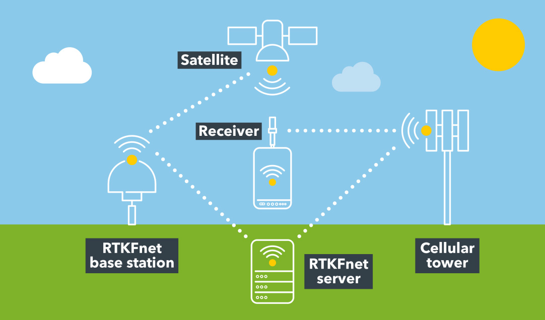
RTK still uses signals from satellites, but it does more. Our base stations communicate with your GPS device (the receiver) and send corrected data to it in real-time.
As the largest independent RTK signal provider, we have around 200 RTKFnet-owned base stations and repeaters. They continually talk to satellites, cellular towers, your device and our in-house server.
How does RTK help?
1. Your GPS device receives signals from satellites.
2. The base station also receives signals from these satellites.
3. The base station knows its exact position because we carefully place and calibrate it.
4. The base station compares its known location with the position it calculates from satellite signals.
5. Any differences between the location and calculated position are sent to your GPS device.
6. Your device then applies the corrections to its calculations. This makes your location super accurate, often down to a centimetre.
Navigating in our industries


